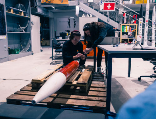
After drop test 3, we discovered our steering lines, these are parachute cords used to steer our descent, were not tight but had significant slack. This meant that even tough we were pulling on the lines, the parachute did not react to those inputs. We discovered this thanks to GoPro video footage from the drop test. We also discovered this was an issue in every drop test we had. To fix this issue, we removed the slack in the lines and wanted to fly one last system identification flight.
We always joke about how we had every type of ground recovery there is. We landed in the trees, on snow, in a ditch. The only thing missing, we thought, was landing in a river, which would fry our electronics. What else could possibly happen?
We always joke about how we had every type of ground recovery there is. We landed in the trees, on snow, in a ditch. The only thing missing, we thought, was landing in a river, which would fry our electronics. What else could possibly happen?
Two days before the scheduled test, we were informed that it is cancelled. We knew this was a possibility, as it was a very tight schedule to begin with. We were missing a few important documents, which is why the Federal Office for Civil Aviation (FOCA, or BAZL in German), could not permit the drop test. However, with one day remaining, our project manager spent hours on the phone with them, clarifying our mission and navigating bureocracy. At 5 PM, 18h before the scheduled drop, we recieved official permission to drop with a commercial helicopter in the Valley of Wichlen.
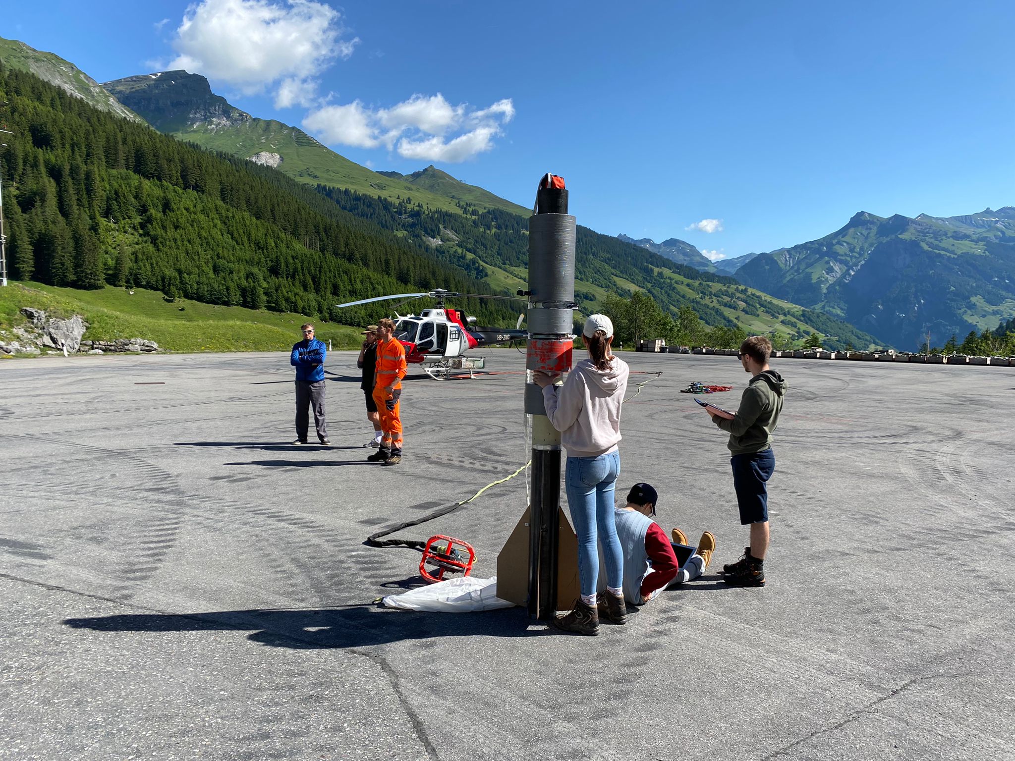
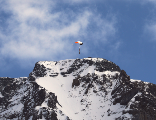
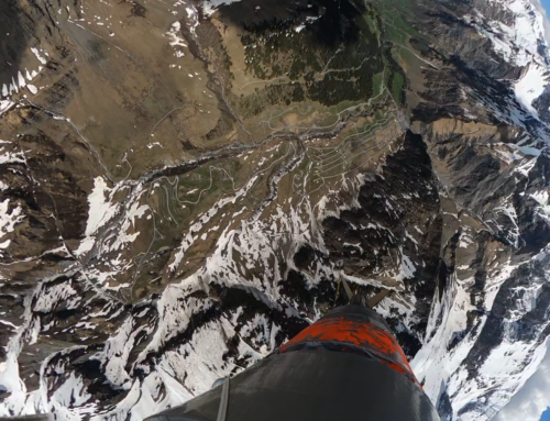
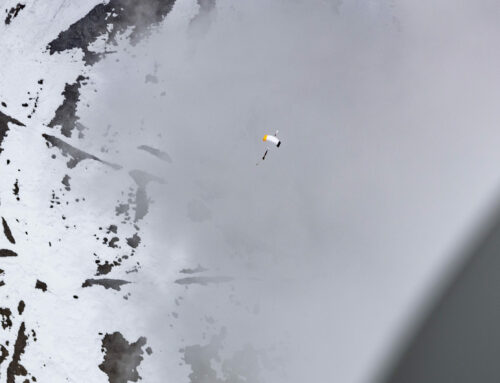
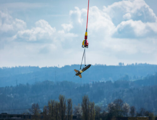
We wanted to drop in the morning, as we expected less wind than in the afternoon. As we were dropping on a Saturday, not the usual Super Puma from the air force, but a commercial Airbus H125 landed. After a quick briefing, we attached the system to the helicopter at 10:30 AM. The pilot took off and flew to the drop point. More than thousand meters above the valley ground, the pilot started the countdown: Three… two… one… drop! After a couple of seconds in drogue descent the main parachute deployed beautifully. Our System Identification script then took over. Slight turn left, hard turn left, slight turn right, hard turn right. These curves, slowly but surely, got us closer and closer to the mountain ridges to the south of the valley.
Then, the call came: “safety spiral!”. We did not want to land on such a steep slope, we hoped a safety spiral would get us closer to the valley floor. But it was all in vain. Our system landed in the bushes halfway up the hillside. Would it have made a difference if the call came earlier? Unlikely. The Safety spiral was not designed for this scenario, but it was worth a try.
Then, the call came: “safety spiral!”. We did not want to land on such a steep slope, we hoped a safety spiral would get us closer to the valley floor. But it was all in vain. Our system landed in the bushes halfway up the hillside. Would it have made a difference if the call came earlier? Unlikely. The Safety spiral was not designed for this scenario, but it was worth a try.
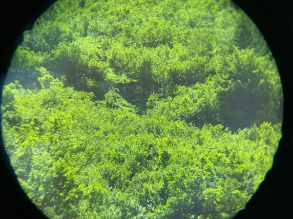
We always assumed that, should the system land there, it would be unrecoverable. No street or trail leads up these incredibly steep ridges. But we really needed that data! So, we came up with a simple plan. The three team members with hiking boots packed water, tools, ropes, and a laptop and try to go up there, to see if it’s possible to even get to the system. And so, the climbing/hiking started. After three hours, they finally reached the system, downloaded the all important data, and shut the electronics down.
But could we get it back down? The slopes were too steep and the bushes too dense to carry it. But it was a solidly built piece of kit, so we started to rappel it down. It took another three hours, with the system constantly hitting the ground, falling down small rock faces, but we made it. After another three hours later, the PERIPHAS rocket and all team members arrived on the valley floor safe and sound. It was a long and exhaustive day but our objective of safely recovering all parts was achieved, and that’s what matters.
Social Contact